|

|
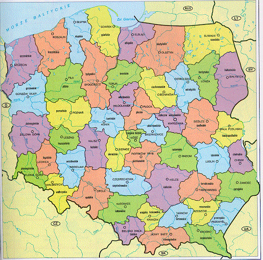
This map shows Poland and its administrative districts, the wojewodstwa, at least as they used to be. I understand that political reform calls for the number of districts to be reduced. My family hails from the Krosnienskie Wojewodstwo, shown in green in the extreme southeastern corner of Poland. The capital city of Krosno was visible on the previous map. The capital city of the neighboring district, Przemysl, partially fit in on the upper right-hand corner of that map.
Polska Atlas Drogowy, GeoCenter, Warsaw, Poland (1997) p. xiii. [ISBN: 83-7129-295-3]
Thanks to Krzysztof Orzechowski for lending me the atlas!
Return to
my personal history page.
Return to
Joe Strzalka's home page.